Sunday, July 27, 2014

Day 7 Maple Creek to Longmire ~10.2miles

I knew the last day was going to be pretty mellow. It had really pounded rain the night before and it was socked in but dry in the morning, so I made myself a second cup of coffee before leaving camp. The whole hike was wooded and while spectacular in its own right - the whole hike was close enough to roads to get day hikers - and probably would have gotten a lot more had the conditions not been off and on rain and low visibility. That being said, it was pretty nice. I wore my 'holy dry clothes' for most of the hike and got to Longmire around 2:30 having left camp around 9:30am.


There were a few small slides on this slope above a creek


You can see the road-cut across the valley. Civilization looms.

Obviously I had great shots of the mountain on my exit. . . but it did keep the trail a little emptier.

Day 6 - Summerland to Maple Creek 15.6miles

The first four miles from Summerland to Indian Bar cross Panhandle Gap, the highest elevation point of the Wonderland Trail. The whole section was pretty burly when I made it with strong headwinds, rain, low visibility and that is because I weathered out a thunderstorm complete with hail at the shelter waiting for these 'better conditions'. There is basically no shelter along the route and I had to open my pack and put on my puffy mid-hike due to the temperature which is pretty unusual since usually climbing a mountain produces plenty of heat. Anyway, we had a really cool little posse camped out at Summerland most of which was headed South and met back up at the Indian Bar shelter to defrost. From Indian Bar I crossed a little snow, but basically dropped into the woods and descended all the way to Nickel Creek, Box Canyon (and virtual civilization), and into Maple Creek.

Summerland meadow


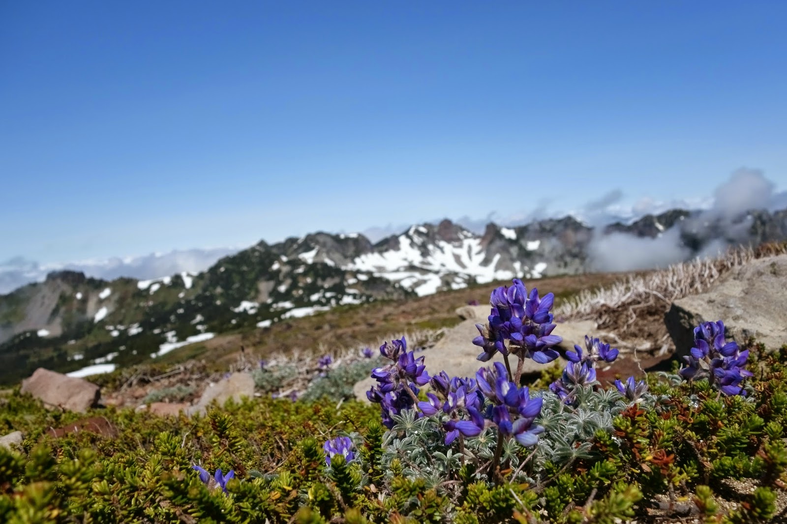
Standard visibility at a pass along near Panhandle Gap

One of the frozen tarns I passed

One of the last shots I took before deciding there was just too much rain


Looking back at Panhandle Gap from Indian Bar - obviously lens was a 'bit' wet
This was the view leaving Indian Bar - the snow leaving Indian Bar wasn't bad - again Panhandle Gap in the background


Day 5 - Mystic to Summerland 20.8miles

Originally I had planned on the previous day ending at Carbon River, but my rough calculations showed about 5,500ft of elevation gain so I shaved a thousand feet and almost 4 miles off of it and camped at Mystic. The result is that Day 5 was a monster day. Jeff and I left camp at 7:30am winding past the Winthrop Glacier before climbing through the woods into Berkley Park before dropping into Sunrise via Sourdough Ridge around 1:30 (~9.2m).  Early in on the day we ran into a geology class doing moraine mapping and water sediment testing and later ran into a handful of people doing the Northern Loop trail which looked like a pretty awesome 2 night trip. It had rained a little over the night and day 5 was mostly cloudy and socked in with a few moments when the sun popped through.


Winthrop Glacier terminous


Right before Berkley Park, we apparently just missed a herd of goats


Looking into the Berkley Park bowl

Berkley Park was amazing - it can easily be day hiked from Sunrise and is on my list to revisit


We crossed dozens of bridges like these

Emmons Glacier coming down from Sunrise


After eating a veggie burger, beer, and then some coffee (and having a bit of a food cache mishap) we left Sunrise for White River which involved us taking some wrong turns and making it a 4.9miles trek rather than the 3.1 it could have been. Jeff and I split ways here and he met up with Joy for a night of car camping.

I think that this is a little piece of Fryingpan Glacier approaching Summerland


Summerland Shelter - where I was lucky enough to spend the night

Saturday, July 26, 2014

Day 4 - Eagles Roost to Mystic (Spray Park Detour) ~11 miles +/- 3

The first three days of the hike didn't seem boring, but the rest of the hike was actually insane. I think it started at Eagles Roost with our neighbors offering us their 'extra' vodka, but continued with a trip to Spray Falls, a several mile detour and route finding mishap above Spray Park and then past the Carbon Glacier, Moraine Park, and 'Old Desolate' mountains - which I am sure is where a very serious and probably upset with wizard lives - and then we found Mystic Lake.
Wakey, Wakey


Note marmot cameo


2nd full on suspension bridge of the hike

So it isn't just that large white thing that is the Carbon Glacier, but that rocky mass in front of it too

The birth of the Carbon River


Seriously a wizard lives here; Nothing should look that menacing under a blue sky.

Friday, July 25, 2014

Day 3 - Golden Lakes to Eagles Roost 12.1miles

I guess I must of slept really well. I was the first one out of camp before 8am and broke cobwebs and knocked last nights rain off of all of the vegetation for the first 5 miles. At some point I looked at my rain gear and it was all insanely covered in bear grass flowers.  The hike started to feel like a real trail on this day - I ended up running into a handful of people I would later run into toward the end of my hike and I got my first re-supply and Jeff joined the hike.  I arrived at Mowich around 1:30pm.

Golden Lakes


I think the Mowich River was my favorite of the whole trip - I don't think this picture really gives a true feeling of how raging and how huge it really was.